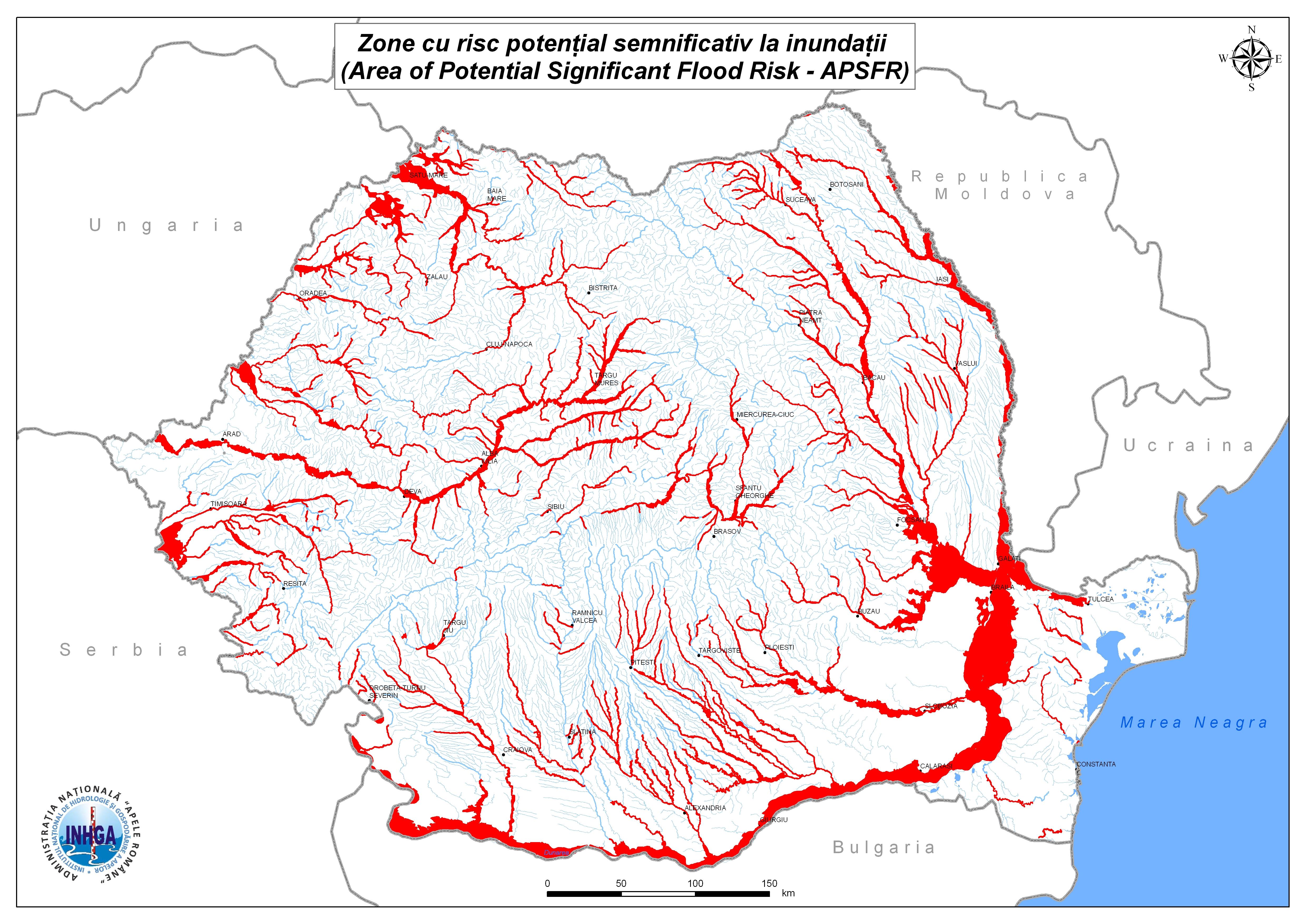
PROJECT
Realization of hazard maps and flood risk
PROJECT NAME:
Realization of hazard maps and flood risk
BENEFICIARY:
"Romanian Waters" National Administration and other public institutions
NEED:
Identifying the areas with significant flood risk and reducing the risk of natural disaster production by implementing preventive measures in vulnerable areas
MAIN DELIVERABLES:
- Scanning the area of interest and creation the topographic profile (DTM)
- Data processing
- Accurate elaboration of risk map which includes: depth or level of water, flood limit, flow capacity etc
CUSTOMER BENEFITS:
- Preliminary assessment of the risk of natural floods/hazards
- Reducing the risk to floods with consequences on the population or on their property
- Sustainable development of the barrier network and of the locality by reducing the damage
- Elaboration of the defense plan against extreme hydro-meteorological phenomena on the hydrographical basin