PROJECT
THE REGISTER OF LOCAL GREEN SPACES – BUCHAREST
PROJECT NAME:
The register of local green spaces from Bucharest Municipality
BENEFICIARY:
Bucharest City Hall
NEED:
Development of an information system for recording and tracking the green spaces from capital
MAIN DELIVERABLES:
- Obtaining the orthophotoplan of Bucharest municipality and the Digital Surface Model
- Obtaining the 3D vector map and the multispectral recordings
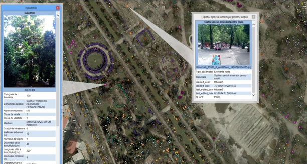
- Recording of the characteristics regarding the RLSV entities (isolated trees, protected trees, green areas and degraded land)
-
Identification and registration of data regarding:
- the owners or managers of green spaces
- the existing buildings located in green areas
-
Determination and registration of characteristics of:
- isolated and protected trees located on the private domain
- buildings and facilities located in green areas
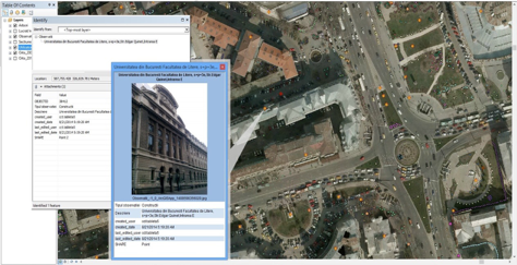
- Realizing and updating the GIS application with data and RLSV monitored parameters
CUSTOMER BENEFITS:
- Realization of an unique system of evidence and inventory of green areas in capital
- Realization of an interactive digital map of green space based on preset criteria
- Monitoring and informing town halls of the district about green space
- Efficient management of trees, green areas and land
- Protecting and preserving the green areas of the city
- Identification of degraded land in the city in order to rehabilitate and use it as a future green space
- Updating data, depending on necessity, in the local register
- Reducing the pollution level and preventing the deforestation or illegal constructions


